Geolocate

Jiri topographic map

Click on the map to display elevation.

About this map

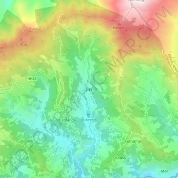
Name: Jiri topographic map, elevation, terrain.

Location: Jiri, Dolakha, Bagmati Province, 45503, Nepal (27.59738 86.19107 27.67738 86.27107)

Average elevation: 2,364 m

Minimum elevation: 1,720 m

Maximum elevation: 3,595 m

Gear up for your next adventure:

🎒Backpack Rain Cover - External shield to keep your entire pack dry
🪑Insulated Seat Pad - Protect your seat from cold rocks and wet logs
🧥Softshell Jacket - Windproof and breathable jacket for hiking
🚲Heavy Duty Bike Lock - Secure your bike at the trailhead or during stops
🛌Down Sleeping Bag - Superior warmth-to-weight ratio for cold nights

As an Amazon Associate, this site earns from qualifying purchases at no extra cost to you.