
Ubud topographic map
Interactive map
Click on the map to display elevation.
About this map
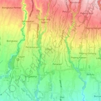
Name: Ubud topographic map, elevation, terrain.
Location: Ubud, Bali, 88571, Indonésie (-8.54809 115.22396 -8.46809 115.30396)
Average elevation: 213 m
Minimum elevation: 101 m
Maximum elevation: 352 m
Other topographic maps
Click on a map to view its topography, its elevation and its terrain.