Geolocate

Kurti topographic map

Click on the map to display elevation.

About this map

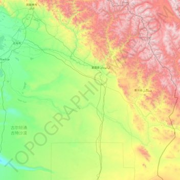
Name: Kurti topographic map, elevation, terrain.

Location: Kurti, Fuyun County, Altay Prefecture, Xinjiang, China (45.41497 88.70769 47.90535 90.07935)

Average elevation: 1,279 m

Minimum elevation: 381 m

Maximum elevation: 3,847 m

Other topographic maps

Click on a map to view its topography, its elevation and its terrain.

Shenzhong Mountain

China > Xinjiang > Fuyun County > Turgun Township

Average elevation: 1,642 m

Gear up for your next adventure:

Lightweight Camping Tent - Portable shelter optimized for Canadian backcountry camping
🥾Hiking Shoes - Durable and comfortable shoes for trail hiking
🛶Waterproof Dry Bags - Keep electronics and clothes dry during river crossings
🥾Waterproof Hiking Boots - Boots keeping your feet dry in wet conditions
🛏️Camping Sleeping Mat - Comfortable mats for sleeping outdoors

As an Amazon Associate, this site earns from qualifying purchases at no extra cost to you.