
Pirawa topographic map
Click on the map to display elevation.
Pirawa
Pirawa is located at 24°10′N 76°02′E / 24.17°N 76.03°E / 24.17; 76.03. It has an average elevation of 370 metres (1213 feet).
About this map
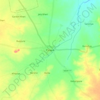
Name: Pirawa topographic map, elevation, terrain.
Average elevation: 384 m
Minimum elevation: 354 m
Maximum elevation: 428 m