Geolocate

Penteleu topographic map

Click on the map to display elevation.

About this map

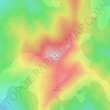
Name: Penteleu topographic map, elevation, terrain.

Location: Penteleu, Gura Teghii, Buzău, Romania (45.60270 26.41684 45.60280 26.41694)

Average elevation: 1,486 m

Minimum elevation: 1,233 m

Maximum elevation: 1,752 m

Gear up for your next adventure:

Lightweight Camping Tent - Portable shelter optimized for Canadian backcountry camping
🛌Insulated Sleeping Pad - Critical thermal barrier between you and the cold ground
🧣Evaporative Cooling Towel - Beat the heat during intense summer climbs
🧴Bear Spray Holster - Quick-access carry for essential Canadian wilderness safety
🧥Waterproof Jacket - Lightweight rain jackets for hiking and outdoor activities

As an Amazon Associate, this site earns from qualifying purchases at no extra cost to you.