Geolocate

Moravia topographic map

Click on the map to display elevation.

About this map

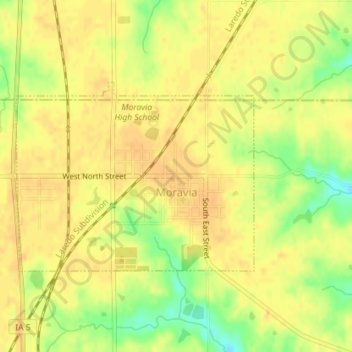
Name: Moravia topographic map, elevation, terrain.

Location: Moravia, Appanoose County, Iowa, United States (40.88513 -92.83080 40.89962 -92.80666)

Average elevation: 300 m

Minimum elevation: 278 m

Maximum elevation: 308 m

Gear up for your next adventure:

🥾Mountaineering Boots - Supportive boots for climbing and high-altitude hiking
🧥Packable Rain Jacket - Breathable waterproof layer for unpredictable weather
🧶550 Survival Paracord - Versatile utility cord for emergency repairs and rigging
🧴Sunscreen SPF - Broad-spectrum sunscreen for outdoor activities
🦶Hiking Shoe Insoles - Added support for high arches and long days on feet

As an Amazon Associate, this site earns from qualifying purchases at no extra cost to you.