Geolocate

Frutillas topographic map

Click on the map to display elevation.

About this map

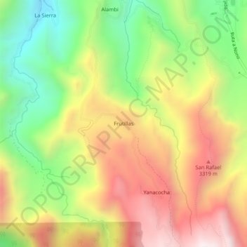
Name: Frutillas topographic map, elevation, terrain.

Location: Frutillas, Nono, Quito Canton, Pichincha, Ecuador (-0.10699 -78.61347 -0.06699 -78.57347)

Average elevation: 2,977 m

Minimum elevation: 2,455 m

Maximum elevation: 3,525 m

Gear up for your next adventure:

🚲MTB Frame Bag - Carry tools and maps directly on your bicycle frame
🚲Heavy Duty Bike Lock - Secure your bike at the trailhead or during stops
🦶Hiking Shoe Insoles - Added support for high arches and long days on feet
🩹Compact First Aid Kit - Pre-packed essentials for common trail injuries
🥾Trail Hiking Boots - Supportive boots for rough trails

As an Amazon Associate, this site earns from qualifying purchases at no extra cost to you.