Geolocate

Kimunyu topographic map

Click on the map to display elevation.

About this map

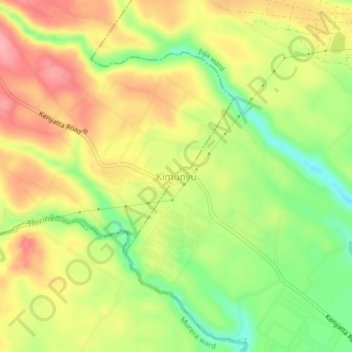
Name: Kimunyu topographic map, elevation, terrain.

Location: Kimunyu, Juja ward, Juja, Kiambu, Central Kenya, Kenya (-1.07549 36.92941 -1.03549 36.96941)

Average elevation: 1,583 m

Minimum elevation: 1,523 m

Maximum elevation: 1,636 m

Gear up for your next adventure:

🧥Waterproof Hiking Jacket - Protect yourself from rain and wind while hiking
🌬️Windproof Camp Stove - Efficient cooking even on exposed mountain peaks
🧥Thermal Layer - Insulating layer for cold outdoor conditions
Camping Groundsheet - Protect your tent from moisture and dirt
🧤Rechargeable Heated Gloves - Extreme warmth for Canadian winter expeditions

As an Amazon Associate, this site earns from qualifying purchases at no extra cost to you.