
Make a donation
Gear up for your next adventure:
As an Amazon Associate, this site earns from qualifying purchases at no extra cost to you.
Eggebek topographic map
Click on the map to display elevation.
Make a donation
Gear up for your next adventure:
As an Amazon Associate, this site earns from qualifying purchases at no extra cost to you.
About this map
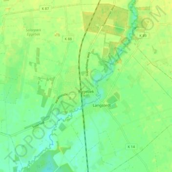
Name: Eggebek topographic map, elevation, terrain.
Location: Eggebek, Schleswig-Flensburg, Schleswig-Holstein, 24852, Germany (54.59834 9.31876 54.64494 9.40279)
Average elevation: 18 m
Minimum elevation: 8 m
Maximum elevation: 25 m
Make a donation
Gear up for your next adventure:
As an Amazon Associate, this site earns from qualifying purchases at no extra cost to you.
Other topographic maps
Click on a map to view its topography, its elevation and its terrain.
Schleswig
Germany > Schleswig-Holstein > Schleswig-Flensburg > Schleswig > Schleswig
Average elevation: 24 m
Make a donation
Gear up for your next adventure:
As an Amazon Associate, this site earns from qualifying purchases at no extra cost to you.