Geolocate

Peio topographic map

Click on the map to display elevation.

About this map

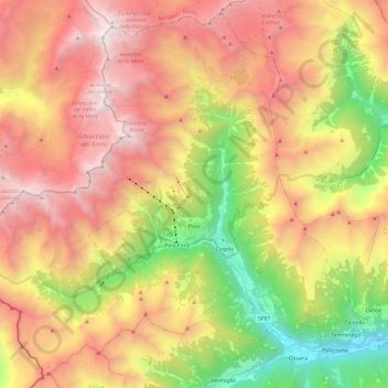
Name: Peio topographic map, elevation, terrain.

Location: Peio, Comunità della Valle di Sole, Provincia di Trento, Trentino – Alto Adige/Südtirol, 38020, Italy (46.29882 10.51566 46.45408 10.75583)

Average elevation: 2,345 m

Minimum elevation: 896 m

Maximum elevation: 3,730 m

Other topographic maps

Click on a map to view its topography, its elevation and its terrain.

Gear up for your next adventure:

Bushcraft Tarp - Versatile emergency shelter or gear protection
🛁Quick-Dry Microfiber Towel - Space-saving towel that dries rapidly on the move
🧊Portable Cooler - Keep food and drinks cold during outdoor adventures
🕯️Camping Lantern - Illuminates your entire campsite with high-efficiency LEDs
🛶Kayak Accessories - Essential gear for safe and fun kayaking adventures

As an Amazon Associate, this site earns from qualifying purchases at no extra cost to you.