Geolocate

Bridgetown topographic map

Click on the map to display elevation.

About this map

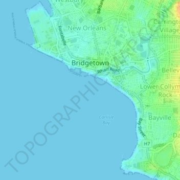
Name: Bridgetown topographic map, elevation, terrain.

Location: Bridgetown, Saint Michael, Barbados (13.07670 -59.63299 13.10890 -59.59946)

Average elevation: 5 m

Minimum elevation: 0 m

Maximum elevation: 30 m

Gear up for your next adventure:

🧢Beanie Hat - Keep your head warm in cold weather
🧦Outdoor Socks - Durable socks designed for hiking and outdoor sports
🥾Trail Running Boots - Durable shoes designed for trail running
🧥Softshell Hiking Jacket - The perfect balance of wind protection and breathability
Lightweight Camping Tent - Portable shelter optimized for Canadian backcountry camping

As an Amazon Associate, this site earns from qualifying purchases at no extra cost to you.