
Saint Joseph topographic map
Click on the map to display elevation.
About this map
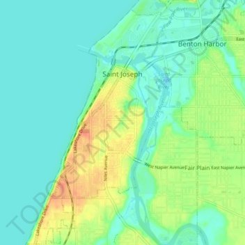
Name: Saint Joseph topographic map, elevation, terrain.
Location: Saint Joseph, Berrien County, Michigan, United States (42.06879 -86.51105 42.12487 -86.46453)
Average elevation: 185 m
Minimum elevation: 172 m
Maximum elevation: 211 m
Other topographic maps
Click on a map to view its topography, its elevation and its terrain.
Grand Mere State Park
United States > Michigan > Berrien County > Lincoln Charter Township
Average elevation: 185 m
Grand Mere State Park
United States > Michigan > Berrien County > Lincoln Charter Township
Average elevation: 185 m
Grand Mere State Park
United States > Michigan > Berrien County > Stevensville
Average elevation: 185 m
Grand Mere State Park
United States > Michigan > Berrien County > Stevensville
Average elevation: 185 m