Geolocate

Estacahan topographic map

Click on the map to display elevation.

About this map

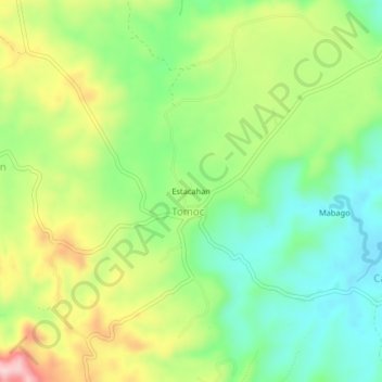
Name: Estacahan topographic map, elevation, terrain.

Location: Estacahan, Tomoc, Bohol, Central Visayas, Philippines (9.96556 124.26472 10.00556 124.30472)

Average elevation: 130 m

Minimum elevation: 39 m

Maximum elevation: 269 m

Gear up for your next adventure:

🧥Waterproof Pants - Keep dry during rainy hiking conditions
Camping Coffee Maker - Brew fresh coffee anywhere on the topographic map
🍽️Titanium Camping Spork - Ultralight and indestructible eating utensil
🥾Mountain Hiking Boots - High-traction boots for rocky terrain
🗺️Topographic Maps - Detailed maps to explore trails, mountains, and wilderness areas

As an Amazon Associate, this site earns from qualifying purchases at no extra cost to you.