
Thank you for supporting this site ❤️
Make a donation
Make a donation
Gear up for your next adventure:
As an Amazon Associate, this site earns from qualifying purchases at no extra cost to you.
Romagna topographic map
Click on the map to display elevation.
Thank you for supporting this site ❤️
Make a donation
Make a donation
Gear up for your next adventure:
As an Amazon Associate, this site earns from qualifying purchases at no extra cost to you.
About this map
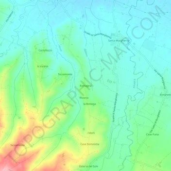
Name: Romagna topographic map, elevation, terrain.
Location: Romagna, Fidenza, Parma, Emilia-Romagna, 43036, Italia (44.80390 10.05972 44.84390 10.09972)
Average elevation: 114 m
Minimum elevation: 73 m
Maximum elevation: 225 m
Thank you for supporting this site ❤️
Make a donation
Make a donation
Gear up for your next adventure:
As an Amazon Associate, this site earns from qualifying purchases at no extra cost to you.