
Waynesville topographic map
Click on the map to display elevation.
About this map
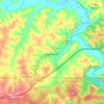
Name: Waynesville topographic map, elevation, terrain.
Location: Waynesville, Pulaski County, Missouri, 65583, United States (37.78363 -92.26846 37.84757 -92.17861)
Average elevation: 286 m
Minimum elevation: 228 m
Maximum elevation: 356 m
Other topographic maps
Click on a map to view its topography, its elevation and its terrain.