
Thank you for supporting this site ❤️
Make a donation
Make a donation
Gear up for your next adventure:
As an Amazon Associate, this site earns from qualifying purchases at no extra cost to you.
Gamach topographic map
Click on the map to display elevation.
Thank you for supporting this site ❤️
Make a donation
Make a donation
Gear up for your next adventure:
As an Amazon Associate, this site earns from qualifying purchases at no extra cost to you.
About this map
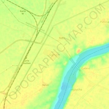
Name: Gamach topographic map, elevation, terrain.
Location: Gamach, Talera Tehsil, Bundi, Rajasthan, 323601, Inde (25.25245 75.87797 25.29245 75.91797)
Average elevation: 248 m
Minimum elevation: 228 m
Maximum elevation: 257 m
Thank you for supporting this site ❤️
Make a donation
Make a donation
Gear up for your next adventure:
As an Amazon Associate, this site earns from qualifying purchases at no extra cost to you.