Geolocate

Mandla topographic map

Click on the map to display elevation.

About this map

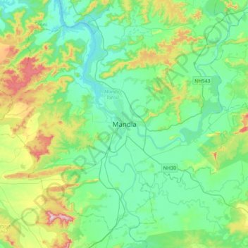
Name: Mandla topographic map, elevation, terrain.

Location: Mandla, Mandla Tahsil, Mandla, Madhya Pradesh, 481661, India (22.43781 80.21208 22.75781 80.53208)

Average elevation: 490 m

Minimum elevation: 412 m

Maximum elevation: 733 m

Gear up for your next adventure:

🩹Moleskin Blister Pads - Direct protection for painful foot pressure points
🥾Approach Shoes - Shoes designed for climbing approaches and rugged trails
🧢Outdoor Visor - Breathable visor for sunny hikes
🗺️Topographic Maps - Detailed maps to explore trails, mountains, and wilderness areas
🧴Waterproofing Spray - Restore the DWR coating on jackets and tents

As an Amazon Associate, this site earns from qualifying purchases at no extra cost to you.