
Mill Hill Regional Park topographic map
Interactive map
Click on the map to display elevation.
About this map
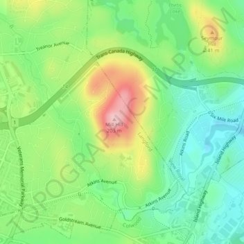
Name: Mill Hill Regional Park topographic map, elevation, terrain.
Average elevation: 74 m
Minimum elevation: 3 m
Maximum elevation: 195 m
Other topographic maps
Click on a map to view its topography, its elevation and its terrain.
Skirt Mountain
Canada > British Columbia > Langford
Skirt Mountain, Langford, Capital Regional District, British Columbia, V9B 0B2, Canada
Average elevation: 158 m