
San Rafael - El Placer topographic map
Interactive map
Click on the map to display elevation.
About this map
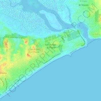
Name: San Rafael - El Placer topographic map, elevation, terrain.
Location: San Rafael - El Placer, Maldonado, 20100, Uruguay (-34.93971 -54.92332 -34.90472 -54.86609)
Average elevation: 7 m
Minimum elevation: -4 m
Maximum elevation: 40 m