
Krupka topographic map
Interactive map
Click on the map to display elevation.
About this map
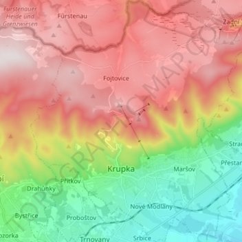
Name: Krupka topographic map, elevation, terrain.
Location: Krupka, okres Teplice, Ústecký kraj, Noordwest, Tsjechië (50.65918 13.80837 50.74280 13.92886)
Average elevation: 526 m
Minimum elevation: 171 m
Maximum elevation: 876 m