
Thank you for supporting this site ❤️
Make a donation
Make a donation
Gear up for your next adventure:
As an Amazon Associate, this site earns from qualifying purchases at no extra cost to you.
Tumaini topographic map
Click on the map to display elevation.
Thank you for supporting this site ❤️
Make a donation
Make a donation
Gear up for your next adventure:
As an Amazon Associate, this site earns from qualifying purchases at no extra cost to you.
About this map
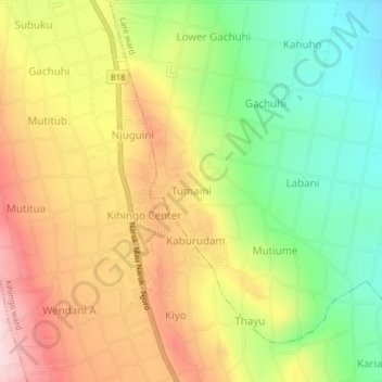
Name: Tumaini topographic map, elevation, terrain.
Location: Tumaini, Lare ward, Njoro, Nakuru, Kenya (-0.44977 35.95807 -0.40977 35.99807)
Average elevation: 2,237 m
Minimum elevation: 2,098 m
Maximum elevation: 2,385 m
Thank you for supporting this site ❤️
Make a donation
Make a donation
Gear up for your next adventure:
As an Amazon Associate, this site earns from qualifying purchases at no extra cost to you.