
Bascharage topographic map
Interactive map
Click on the map to display elevation.
About this map
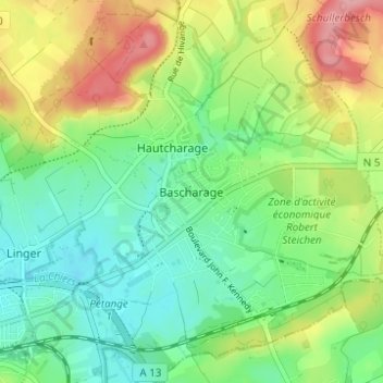
Name: Bascharage topographic map, elevation, terrain.
Location: Bascharage, Käerjeng, Canton Capellen, 4955, Luxembourg (49.55127 5.89285 49.59127 5.93285)
Average elevation: 313 m
Minimum elevation: 270 m
Maximum elevation: 388 m