Geolocate

Whitwell topographic map

Click on the map to display elevation.

About this map

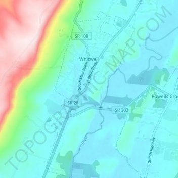
Name: Whitwell topographic map, elevation, terrain.

Location: Whitwell, Marion County, East Tennessee, Tennessee, 37397, United States (35.16307 -85.53624 35.22047 -85.49740)

Average elevation: 282 m

Minimum elevation: 187 m

Maximum elevation: 665 m

Other topographic maps

Click on a map to view its topography, its elevation and its terrain.

Deadman Eddy

United States > Tennessee > Marion County

Average elevation: 355 m

Haletown

United States > Tennessee > Marion County

Average elevation: 286 m

Pinhook

United States > Tennessee > Marion County

Average elevation: 304 m

Ladds

United States > Tennessee > Marion County

Average elevation: 291 m

Haletown

United States > Tennessee > Marion County

Average elevation: 286 m

Bullhead

United States > Tennessee > Marion County

Average elevation: 329 m

Gear up for your next adventure:

🛏️Sleeping Bag - Warm and compact sleeping bags for outdoor camping
🎒Hiking Backpack - Lightweight and ergonomic backpacks for day hikes or multi-day treks
Family Camping Tent - Spacious tent suitable for family camping trips
🦯Trekking Poles - Reduced impact on joints for steep topographic climbs
🛌Down Sleeping Bag - Superior warmth-to-weight ratio for cold nights

As an Amazon Associate, this site earns from qualifying purchases at no extra cost to you.