Geolocate

Bullsbrook topographic map

Click on the map to display elevation.

About this map

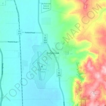
Name: Bullsbrook topographic map, elevation, terrain.

Location: Bullsbrook, Joondalup, Western Australia, 6084, Australia (-31.70374 115.98727 -31.62374 116.06727)

Average elevation: 85 m

Minimum elevation: 24 m

Maximum elevation: 252 m

Gear up for your next adventure:

🪑Insulated Seat Pad - Protect your seat from cold rocks and wet logs
🔋Solar Power Bank - Keep your GPS and devices charged during long outdoor trips
🥾Mountaineering Boots - Supportive boots for climbing and high-altitude hiking
🧣Evaporative Cooling Towel - Beat the heat during intense summer climbs
🥾Light Hiking Boots - Lightweight and comfortable boots for day hikes

As an Amazon Associate, this site earns from qualifying purchases at no extra cost to you.