Geolocate

Bojaba topographic map

Click on the map to display elevation.

About this map

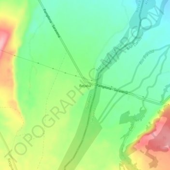
Name: Bojaba topographic map, elevation, terrain.

Location: Bojaba, Cubará, Gutiérrez, Boyacá, Colombia (6.94676 -71.99958 6.98676 -71.95958)

Average elevation: 308 m

Minimum elevation: 253 m

Maximum elevation: 398 m

Gear up for your next adventure:

🎒Backpack Rain Cover - External shield to keep your entire pack dry
🧴Bear Spray Holster - Quick-access carry for essential Canadian wilderness safety
🌬️Windproof Camp Stove - Efficient cooking even on exposed mountain peaks
👟Sport Hiking Sandals - Breathable footwear for water crossings and camp rest
🥾Hiking Shoes - Durable and comfortable shoes for trail hiking

As an Amazon Associate, this site earns from qualifying purchases at no extra cost to you.