
Glen Elder topographic map
Interactive map
Click on the map to display elevation.
About this map
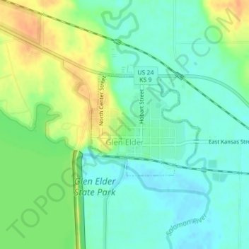
Name: Glen Elder topographic map, elevation, terrain.
Location: Glen Elder, Mitchell County, Kansas, 67446, United States (39.49484 -98.31329 39.50591 -98.29816)
Average elevation: 441 m
Minimum elevation: 427 m
Maximum elevation: 462 m
Other topographic maps
Click on a map to view its topography, its elevation and its terrain.
Asherville
United States > Kansas > Mitchell County
Asherville, Mitchell County, Kansas, 67478, United States
Average elevation: 412 m
Victor
United States > Kansas > Mitchell County
Victor, Mitchell County, Kansas, United States
Average elevation: 460 m
Simpson
United States > Kansas > Mitchell County
Simpson, Mitchell County, Kansas, 67478, United States
Average elevation: 407 m
Beloit
United States > Kansas > Mitchell County
Beloit, Mitchell County, Kansas, United States
Average elevation: 432 m
Hunter
United States > Kansas > Mitchell County
Hunter, Mitchell County, Kansas, United States
Average elevation: 495 m