Geolocate

Ganzhou topographic map

Click on the map to display elevation.

About this map

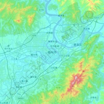
Name: Ganzhou topographic map, elevation, terrain.

Location: Ganzhou, Zhanggong District, Ganzhou, Jiangxi, 341100, China (25.67321 114.76874 25.99321 115.08874)

Average elevation: 208 m

Minimum elevation: 89 m

Maximum elevation: 988 m

Gear up for your next adventure:

🚲MTB Frame Bag - Carry tools and maps directly on your bicycle frame
🧣Merino Neck Gaiter - Protects against wind, sun, and cold at high altitudes
🐕Hiking Dog Pack - Let your canine companion carry their own water and food
🧢Hiking Sun Hat - Wide-brimmed protection for exposed mountain ridges
🥾Hiking Leggings - Comfortable leggings for outdoor activities

As an Amazon Associate, this site earns from qualifying purchases at no extra cost to you.