Geolocate

Paihual topographic map

Click on the map to display elevation.

About this map

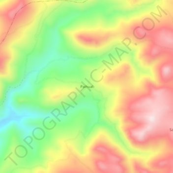
Name: Paihual topographic map, elevation, terrain.

Location: Paihual, Agallpampa, Otuzco, La Libertad, Perú (-7.92060 -78.44736 -7.88060 -78.40736)

Average elevation: 3,576 m

Minimum elevation: 3,348 m

Maximum elevation: 3,790 m

Other topographic maps

Click on a map to view its topography, its elevation and its terrain.

Laguna Tambo

Perú > La Libertad > Agallpampa

Average elevation: 3,810 m

Gear up for your next adventure:

💧Reusable Water Bottle - Durable water bottles for hydration on trails
🔥Camping Stove - Portable stoves to cook outdoors with ease
💧Filtered Water Bottle - Safe drinking water on the go
🕯️Camping Lantern - Illuminates your entire campsite with high-efficiency LEDs
Family Camping Tent - Spacious tent suitable for family camping trips

As an Amazon Associate, this site earns from qualifying purchases at no extra cost to you.