
Thank you for supporting this site ❤️
Make a donation
Make a donation
Gear up for your next adventure:
As an Amazon Associate, this site earns from qualifying purchases at no extra cost to you.
Poroma topographic map
Click on the map to display elevation.
Thank you for supporting this site ❤️
Make a donation
Make a donation
Gear up for your next adventure:
As an Amazon Associate, this site earns from qualifying purchases at no extra cost to you.
About this map
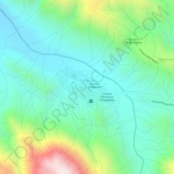
Name: Poroma topographic map, elevation, terrain.
Location: Poroma, Provincia Oropeza, Chuquisaca, Bolivia (-18.54203 -65.43129 -18.53637 -65.42280)
Average elevation: 2,443 m
Minimum elevation: 2,271 m
Maximum elevation: 2,854 m
Thank you for supporting this site ❤️
Make a donation
Make a donation
Gear up for your next adventure:
As an Amazon Associate, this site earns from qualifying purchases at no extra cost to you.