
Distrito La Pintada topographic map
Interactive map
Click on the map to display elevation.
About this map
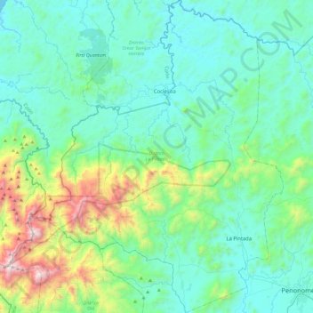
Name: Distrito La Pintada topographic map, elevation, terrain.
Location: Distrito La Pintada, Coclé, Panamá (8.48769 -80.75288 8.94192 -80.38106)
Average elevation: 299 m
Minimum elevation: 0 m
Maximum elevation: 1,661 m
Other topographic maps
Click on a map to view its topography, its elevation and its terrain.