
Thank you for supporting this site ❤️
Make a donation
Make a donation
Gear up for your next adventure:
As an Amazon Associate, this site earns from qualifying purchases at no extra cost to you.
Toscolano topographic map
Click on the map to display elevation.
Thank you for supporting this site ❤️
Make a donation
Make a donation
Gear up for your next adventure:
As an Amazon Associate, this site earns from qualifying purchases at no extra cost to you.
About this map
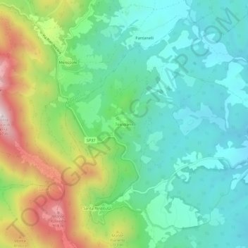
Name: Toscolano topographic map, elevation, terrain.
Location: Toscolano, Avigliano Umbro, Terni, Umbrien, 05020, Italien (42.63802 12.33031 42.67802 12.37031)
Average elevation: 545 m
Minimum elevation: 353 m
Maximum elevation: 978 m
Thank you for supporting this site ❤️
Make a donation
Make a donation
Gear up for your next adventure:
As an Amazon Associate, this site earns from qualifying purchases at no extra cost to you.