
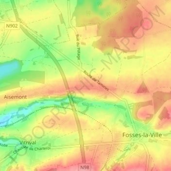
Névremont topographic map
Interactive map
Click on the map to display elevation.
About this map
Name: Névremont topographic map, elevation, terrain.
Location: Névremont, Fosses-la-Ville, Namur, Wallonie, 5070, Belgique (50.38750 4.65720 50.42750 4.69720)
Average elevation: 187 m
Minimum elevation: 135 m
Maximum elevation: 227 m
Other topographic maps
Click on a map to view its topography, its elevation and its terrain.