
Yopal topographic map
Click on the map to display elevation.
Yopal
Yopal es la ciudad capital del departamento colombiano de Casanare, ubicada cerca del río Cravo Sur, en el piedemonte de la cordillera Oriental. Por su topografía el municipio presenta tres pisos térmicos, cuyas áreas son: Cálido 1906 km², Medio 106 km² y Frío 25 km².
About this map
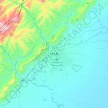
Name: Yopal topographic map, elevation, terrain.
Location: Yopal, Casanare, 850001, Colombia (5.17567 -72.55369 5.49567 -72.23369)
Average elevation: 466 m
Minimum elevation: 203 m
Maximum elevation: 2,091 m