Geolocate

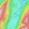
73160 topographic map

Click on the map to display elevation.

About this map

Name: 73160 topographic map, elevation, terrain.

Location: 73160, Saint-Thibaud-de-Couz, Chambéry, Savoie, Auvergne-Rhône-Alpes, France métropolitaine, France (45.42042 5.79043 45.57969 5.90870)

Average elevation: 748 m

Minimum elevation: 247 m

Maximum elevation: 1,931 m

Other topographic maps

Click on a map to view its topography, its elevation and its terrain.
Gear up for your next adventure:

🥾Lightweight Hiking Shoes - Comfortable shoes for day hikes
🧴First Aid Kit - Essential first aid supplies for outdoor emergencies
💡LED Headlamp - Hands-free illumination for night hiking and camping
🧭GPS Outdoor Watch - Smart watch for navigation and fitness tracking in nature
🧣Evaporative Cooling Towel - Beat the heat during intense summer climbs

As an Amazon Associate, this site earns from qualifying purchases at no extra cost to you.