Geolocate

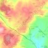
Reiriz topographic map

Click on the map to display elevation.

About this map

Name: Reiriz topographic map, elevation, terrain.

Location: Reiriz, O Saviñao, Tierra de Lemos, Lugo, Galicia, España (42.70958 -7.68898 42.74128 -7.63499)

Average elevation: 464 m

Minimum elevation: 324 m

Maximum elevation: 631 m

Other topographic maps

Click on a map to view its topography, its elevation and its terrain.

Escairón

España > Galicia > Tierra de Lemos > O Saviñao

Average elevation: 587 m

Souceda

España > Galicia > Tierra de Lemos > O Saviñao > Souceda

Average elevation: 662 m

Currelos

España > Galicia > Tierra de Lemos > O Saviñao

Average elevation: 543 m

Gear up for your next adventure:

🔦LED Headtorch - Bright and durable light for night activities
🪜Heavy Duty Carabiners - Multi-use clips for securing gear to your backpack
☕Camping Coffee Maker - Brew fresh coffee anywhere on the topographic map
🥾Light Trekking Boots - Supportive boots for multi-day treks
🔨Vehicle Emergency Tool - Safety tool for remote road trips to trailheads

As an Amazon Associate, this site earns from qualifying purchases at no extra cost to you.