
Fenton topographic map
Click on the map to display elevation.
About this map
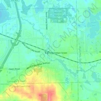
Name: Fenton topographic map, elevation, terrain.
Location: Fenton, Genesee County, Michigan, 48430, United States (42.77801 -83.75196 42.81981 -83.68430)
Average elevation: 280 m
Minimum elevation: 262 m
Maximum elevation: 337 m
Other topographic maps
Click on a map to view its topography, its elevation and its terrain.
Genessee County Recreational Area
United States > Michigan > Genesee County > Genesee Charter Township
Average elevation: 231 m