Geolocate

Mougás topographic map

Click on the map to display elevation.

About this map
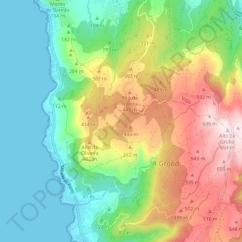
Name: Mougás topographic map, elevation, terrain.

Location: Mougás, Oia, Bajo Miño, Pontevedra, Galicia, España (42.04139 -8.89866 42.10395 -8.83118)

Average elevation: 235 m

Minimum elevation: -1 m

Maximum elevation: 650 m

Gear up for your next adventure:

🔦LED Headlamp - Hands-free lighting for early morning starts or late finishes
🔭Compact Binoculars - Lightweight optics for scouting trails and wildlife
🔋Lithium AA Batteries - Long-lasting power that performs in extreme cold
🥾All-Terrain Hiking Boots - Versatile boots for varied hiking conditions
💡Portable Camping Lamp - Rechargeable lamp for campsite lighting

As an Amazon Associate, this site earns from qualifying purchases at no extra cost to you.