Geolocate

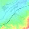
Tazmalt topographic map

Click on the map to display elevation.

About this map

Name: Tazmalt topographic map, elevation, terrain.

Location: Tazmalt, Tazmalt District, Bejaia, 06006, Algeria (36.36309 4.37381 36.43235 4.47221)

Average elevation: 459 m

Minimum elevation: 212 m

Maximum elevation: 1,252 m

Other topographic maps

Click on a map to view its topography, its elevation and its terrain.
Boudraâ

Algeria > Bejaia > Tazmalt District > Beni Melikeche

Average elevation: 1,132 m

Aftis

Algeria > Bejaia > Tazmalt District > Boudjellil

Average elevation: 255 m

Gear up for your next adventure:

🥾Trail Running Shoes - Lightweight and durable shoes for trail running
💡Solar Camping Lamp - Eco-friendly lighting for campsites
🧴Bear Spray Holster - Quick-access carry for essential Canadian wilderness safety
🚲Heavy Duty Bike Lock - Secure your bike at the trailhead or during stops
💧Collapsible Water Bottle - Space-saving water bottle for outdoor activities

As an Amazon Associate, this site earns from qualifying purchases at no extra cost to you.