
Tapalpa topographic map
Interactive map
Click on the map to display elevation.
About this map
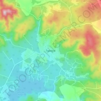
Name: Tapalpa topographic map, elevation, terrain.
Location: Tapalpa, Jalisco, 49340, México (19.90490 -103.79760 19.98490 -103.71760)
Average elevation: 2,148 m
Minimum elevation: 1,999 m
Maximum elevation: 2,485 m
Other topographic maps
Click on a map to view its topography, its elevation and its terrain.
Ferrería de Tula
Ferrería de Tula, Tapalpa, Jalisco, México
Average elevation: 2,365 m