Geolocate

Khandala topographic map

Click on the map to display elevation.

Khandala

Adjacent to the Lohagad fort lies the visapur fort which is part of the Lohagad-Visapur fortification. Visapur Fort is larger and at a higher elevation than its twin- Lohagad. It was built during 1713-1720 CE by Balaji Vishwanath.

Wikipedia (CC-BY-SA 3.0)

About this map

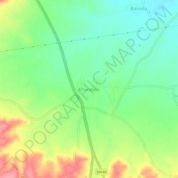
Name: Khandala topographic map, elevation, terrain.

Location: Khandala, Satara, Maharashtra, 412802, India (18.03840 73.99482 18.07840 74.03482)

Average elevation: 662 m

Minimum elevation: 623 m

Maximum elevation: 724 m

Gear up for your next adventure:

Lightweight Camping Tent - Portable shelter optimized for Canadian backcountry camping
🕯️Camping Lantern - Illuminates your entire campsite with high-efficiency LEDs
🪜Heavy Duty Carabiners - Multi-use clips for securing gear to your backpack
🧳Compression Sacks - Maximize space in your backpack by shrinking gear
🕶️Polarized Sunglasses - Reduces glare from snow and water at high elevations

As an Amazon Associate, this site earns from qualifying purchases at no extra cost to you.