Geolocate

Beni Tamou topographic map

Click on the map to display elevation.

About this map
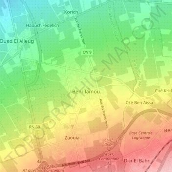
Name: Beni Tamou topographic map, elevation, terrain.

Location: Beni Tamou, Oued El Alleug District, Blida, 09000, Algeria (36.50856 2.77243 36.57044 2.84334)

Average elevation: 92 m

Minimum elevation: 23 m

Maximum elevation: 177 m

Gear up for your next adventure:

🚑Survival Whistle - Signal for help across long distances in mountains
🚲MTB Frame Bag - Carry tools and maps directly on your bicycle frame
⛺Camping Groundsheet - Protect your tent from moisture and dirt
🧢Beanie Hat - Keep your head warm in cold weather
🥾Mountaineering Boots - Supportive boots for climbing and high-altitude hiking

As an Amazon Associate, this site earns from qualifying purchases at no extra cost to you.