
Mingguang topographic map
Interactive map
Click on the map to display elevation.
About this map
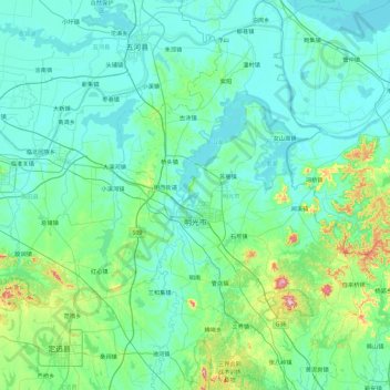
Name: Mingguang topographic map, elevation, terrain.
Location: Mingguang, Chuzhou, Anhui, 233000, Chine (32.44919 117.82901 33.21953 118.42436)
Average elevation: 46 m
Minimum elevation: 9 m
Maximum elevation: 316 m
Other topographic maps
Click on a map to view its topography, its elevation and its terrain.