Geolocate

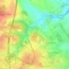
Les Charriers topographic map

Click on the map to display elevation.

About this map

Name: Les Charriers topographic map, elevation, terrain.

Location: Les Charriers, Saintes, Charente-Maritime, Nouvelle-Aquitaine, France métropolitaine, 17100, France (45.70702 -0.66302 45.74702 -0.62302)

Average elevation: 25 m

Minimum elevation: -2 m

Maximum elevation: 63 m

Other topographic maps

Click on a map to view its topography, its elevation and its terrain.
Gear up for your next adventure:

🌬️Windproof Camp Stove - Efficient cooking even on exposed mountain peaks
🛁Quick-Dry Microfiber Towel - Space-saving towel that dries rapidly on the move
🧦Hiking Socks - Moisture-wicking and comfortable socks for long hikes
⛺Backpacking Tent - Lightweight tent for long-distance hiking trips
🛶Kayak Accessories - Essential gear for safe and fun kayaking adventures

As an Amazon Associate, this site earns from qualifying purchases at no extra cost to you.