Geolocate

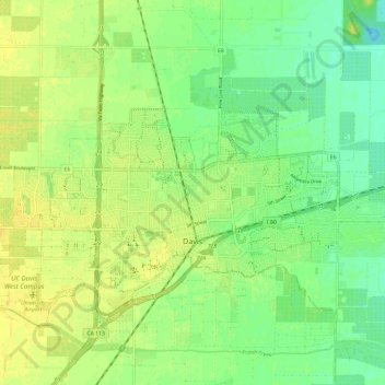
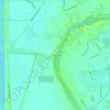
Davis topographic map

Click on the map to display elevation.

Davis

Davis lies in the Sacramento Valley, the northern portion of the Central Valley, in Northern California, at an elevation of about 52 feet (16 m) above sea level.

Wikipedia (CC-BY-SA 3.0)

About this map

Name: Davis topographic map, elevation, terrain.

Location: Davis, Yolo County, California, United States (38.53491 -121.79398 38.57555 -121.67567)

Average elevation: 14 m

Minimum elevation: 2 m

Maximum elevation: 23 m

Other topographic maps

Click on a map to view its topography, its elevation and its terrain.

Madison

United States > California > Yolo County

Average elevation: 47 m

Swingle

United States > California > Yolo County

Average elevation: 8 m

Central

United States > California > Yolo County

Average elevation: 1 m

Gear up for your next adventure:

🧥Thermal Fleece Jacket - Versatile insulation for changing mountain temperatures
🔋Solar Power Bank - Keep your GPS and devices charged during long outdoor trips
🧢Sun Protection Cap - Breathable cap to protect from sun exposure
🧼Biodegradable Camp Soap - Environmentally friendly cleaning for gear and body
🚑Survival Whistle - Signal for help across long distances in mountains

As an Amazon Associate, this site earns from qualifying purchases at no extra cost to you.