
Thank you for supporting this site ❤️
Make a donation
Make a donation
Gear up for your next adventure:
As an Amazon Associate, this site earns from qualifying purchases at no extra cost to you.
Ashtabula topographic map
Click on the map to display elevation.
Thank you for supporting this site ❤️
Make a donation
Make a donation
Gear up for your next adventure:
As an Amazon Associate, this site earns from qualifying purchases at no extra cost to you.
About this map
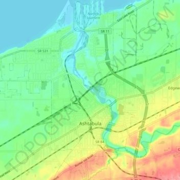
Name: Ashtabula topographic map, elevation, terrain.
Location: Ashtabula, Ashtabula County, Ohio, 44004, United States (41.84358 -80.83720 41.91165 -80.76738)
Average elevation: 200 m
Minimum elevation: 171 m
Maximum elevation: 257 m
Thank you for supporting this site ❤️
Make a donation
Make a donation
Gear up for your next adventure:
As an Amazon Associate, this site earns from qualifying purchases at no extra cost to you.