Geolocate

Bernués topographic map

Click on the map to display elevation.

About this map

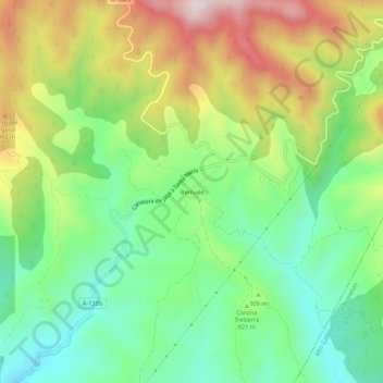
Name: Bernués topographic map, elevation, terrain.

Location: Bernués, Jaca, La Jacetania, Huesca, Aragón, España (42.45814 -0.60599 42.49814 -0.56599)

Average elevation: 926 m

Minimum elevation: 728 m

Maximum elevation: 1,236 m

Other topographic maps

Click on a map to view its topography, its elevation and its terrain.

Ibon de Astun (Truchas)

España > Aragón > La Jacetania > Jaca

Average elevation: 2,048 m

Gear up for your next adventure:

🥘Camping Cookware Set - Compact nesting pots and pans for trail cooking
🧴Outdoor Sunscreen - High SPF protection for high-altitude UV exposure
🛌Insulated Sleeping Pad - Critical thermal barrier between you and the cold ground
💡LED Headlamp - Hands-free illumination for night hiking and camping
🧴Insect Repellent - Protect yourself from bugs during outdoor adventures

As an Amazon Associate, this site earns from qualifying purchases at no extra cost to you.