Geolocate

Vaughn topographic map

Click on the map to display elevation.

About this map

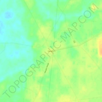
Name: Vaughn topographic map, elevation, terrain.

Location: Vaughn, Morehouse Parish, Louisiana, United States (32.93207 -91.98319 32.97207 -91.94319)

Average elevation: 29 m

Minimum elevation: 15 m

Maximum elevation: 43 m

Gear up for your next adventure:

🧣Merino Neck Gaiter - Protects against wind, sun, and cold at high altitudes
🎒Fully Waterproof Backpack - Total protection for photography gear and electronics
Camping Coffee Maker - Brew fresh coffee anywhere on the topographic map
🐕Hiking Dog Pack - Let your canine companion carry their own water and food
🥤Collapsible Travel Cup - Saves space and weight in your mess kit

As an Amazon Associate, this site earns from qualifying purchases at no extra cost to you.