Geolocate

Königsbrunn topographic map

Click on the map to display elevation.

About this map
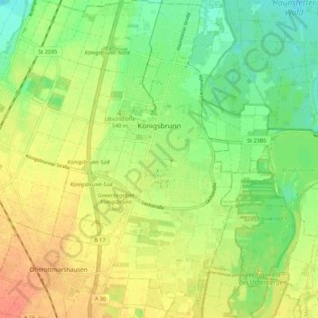
Name: Königsbrunn topographic map, elevation, terrain.

Location: Königsbrunn, Augsburg (district), Bavaria, 86343, Germany (48.22809 10.85511 48.29387 10.91135)

Average elevation: 520 m

Minimum elevation: 499 m

Maximum elevation: 542 m

Other topographic maps

Click on a map to view its topography, its elevation and its terrain.
Erlingen

Germany > Bavaria > Augsburg (district) > Meitingen

Average elevation: 435 m

Gear up for your next adventure:

🥾Hiking Shorts - Breathable shorts suitable for summer hikes
🔋Solar Power Bank - Keep your GPS and devices charged during long outdoor trips
🧥Thermal Fleece Jacket - Versatile insulation for changing mountain temperatures
🧥Thermal Layer - Insulating layer for cold outdoor conditions
🥾Mountain Trail Shoes - High-traction shoes for mountain trails

As an Amazon Associate, this site earns from qualifying purchases at no extra cost to you.