Geolocate

Indapur topographic map

Click on the map to display elevation.

About this map

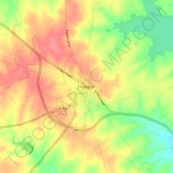
Name: Indapur topographic map, elevation, terrain.

Location: Indapur, Pune District, Maharashtra, 413106, India (18.07707 74.98640 18.15707 75.06640)

Average elevation: 517 m

Minimum elevation: 481 m

Maximum elevation: 545 m

Gear up for your next adventure:

Backpacking Tent - Lightweight tent for long-distance hiking trips
🕶️Polarized Sunglasses - Reduces glare from snow and water at high elevations
🥤Collapsible Travel Cup - Saves space and weight in your mess kit
🧰Multitool Knife - Compact and versatile tool for outdoor use
🚲Bike Repair Kit - Essential tools for on-trail mechanical issues

As an Amazon Associate, this site earns from qualifying purchases at no extra cost to you.