
Frontin topographic map
Interactive map
Click on the map to display elevation.
About this map
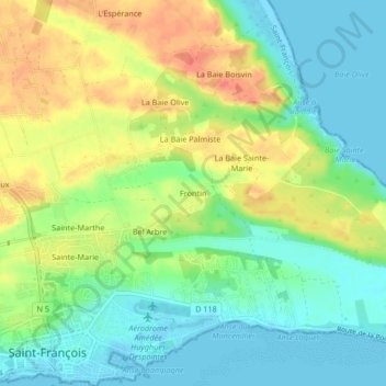
Name: Frontin topographic map, elevation, terrain.
Location: Frontin, Pointe-à-Pitre, Guadeloupe, 97118, France (16.24969 -61.27932 16.28969 -61.23932)
Average elevation: 21 m
Minimum elevation: -1 m
Maximum elevation: 51 m